Search among 2,541 authentic tree difference stock photos, high-definition images, and pictures, or look at other platform cart or ski lift stock images to enhance your presentation with the perfect visual.

Free with trial
Paltinis chairlift was established in 1971 and features a cable installation with 52 seats for 2 people at a speed of 2m per s. It was modernized in 2011,serving the Oncesti track with a length of 1100 meters,with a level difference of 241 meters. The track is also equipped with a 400 meters long ski lift,with a level difference of 138 meters. The track has a nocturnal installation,and since 2013 it has been equipped with snow cannons. Tree difference stock images, royalty-free photos and pictures
Free with trial
Poland, Elblag Canal, Masuria Province - 04. 08. 2023: famous landmark of Warmian-Masurian, Poland. Navigable waterway,boat is hauled and transported on the platform cart to overcome the difference in water levels. Tree difference stock images, royalty-free photos and pictures
Free with trial
Poland, Elblag Canal, Masuria Province - 04. 08. 2023: famous landmark of Warmian-Masurian, Poland. Navigable waterway,boat is hauled and transported on the platform cart to overcome the difference in water levels. Tree difference stock images, royalty-free photos and pictures
Free with trial
Poland, Elblag Canal, Masuria Province - 04. 08. 2023: famous landmark of Warmian-Masurian, Poland. Navigable waterway,boat is hauled and transported on the platform cart to overcome the difference in water levels. Tree difference stock images, royalty-free photos and pictures
Free with trial
Poland, Elblag Canal, Masuria Province - 04. 08. 2023: famous landmark of Warmian-Masurian, Poland. Navigable waterway,boat is hauled and transported on the platform cart to overcome the difference in water levels. Tree difference stock images, royalty-free photos and pictures
Free with trial
Poland, Elblag Canal, Masuria Province - 04. 08. 2023: famous landmark of Warmian-Masurian, Poland. Navigable waterway,boat is hauled and transported on the platform cart to overcome the difference in water levels. Tree difference stock images, royalty-free photos and pictures
Free with trial
Poland, Elblag Canal, Masuria Province - 04. 08. 2023: famous landmark of Warmian-Masurian, Poland. Navigable waterway,boat is hauled and transported on the platform cart to overcome the difference in water levels. Tree difference stock images, royalty-free photos and pictures
Free with trial
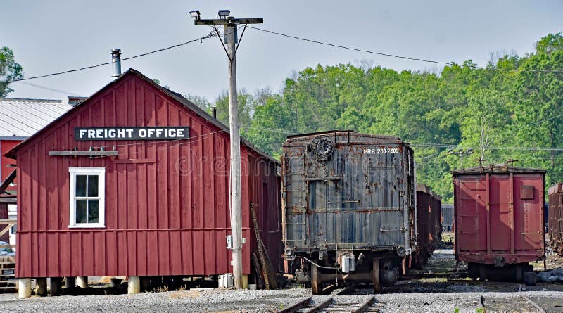
Next to the Freight Office are boxcars of both Standard Gauge and Narrow Gauge showing the difference in size between the two on the East Broad Top Railroad at Rockhill Furnace, PA in June 2023. Tree difference stock images, royalty-free photos and pictures
Free with trial
Lashihai is located in the middle of Lashiba, 10 kilometers west of Lijiang City. It is the first nature reserve in Yunnan Province named after "wetland" and is adjacent to the Flower and Rose Base. Lashi "is the translation of the ancient Naxi language," la "means barren dam," city "means new, meaning new barren dam. Lashihai was originally part of the ancient geosyncline in northwest Yunnan. During the Mesozoic Yanshan Movement, it was folded and uplifted to form a land, and by the Miocene, it became a quasi plain. With the development of the Hengduan Mountains orogeny, by the end of the Pliocene to the beginning of the Pleistocene, this quasi plain under the Yulong Snow Mountain was further divided into three high-altitude mountain basins with a relative height difference of 100 to 200 meters, namely Lashiba, Lijiang Dam, and Qiheba. Lashi Dam is the highest dam among them, and there is still a water area in the dam. Lijiang is an inland area, and when a slightly larger lake is seen, it is called the sea, so it is called Lashi Sea, with an elevation of 2437 meters above sea level. Tree difference stock images, royalty-free photos and pictures
Free with trial
The formation of the Tourism Area of Yarlung Zangbo Grand Canyon is mainly due to the rapid uplift of the Qinghai Tibet Plateau and the combined action of mantle upwelling bodies in the region. The canyon starts from Daduka Village in Pai Town, Milin City, and extends from west to east, bypassing Mount Nanjiabawa before extending southeast to Bashika Village in Motuo County. On the north side of the Yarlung Tsangpo Grand Canyon is the Galabaile Peak of Nyenchen Tanggula, and on the south side is the Nanga Bawa Peak of the Himalayas. The area is high in the north and low in the south, with a height difference of 2500 meters between the mountain top and the valley bottom. The channel shaped terrain has influenced the Yarlung Zangbo Canyon by the warm and humid air currents of the Indian Ocean, resulting in a distinct tropical and subtropical climate with significant vertical differences, and nurturing a rich and diverse range of biological resources. Tree difference stock images, royalty-free photos and pictures
Free with trial
Lashihai is located in the middle of Lashiba, 10 kilometers west of Lijiang City. It is the first nature reserve in Yunnan Province named after "wetland" and is adjacent to the Flower and Rose Base. Lashi "is the translation of the ancient Naxi language," la "means barren dam," city "means new, meaning new barren dam. Lashihai was originally part of the ancient geosyncline in northwest Yunnan. During the Mesozoic Yanshan Movement, it was folded and uplifted to form a land, and by the Miocene, it became a quasi plain. With the development of the Hengduan Mountains orogeny, by the end of the Pliocene to the beginning of the Pleistocene, this quasi plain under the Yulong Snow Mountain was further divided into three high-altitude mountain basins with a relative height difference of 100 to 200 meters, namely Lashiba, Lijiang Dam, and Qiheba. Lashi Dam is the highest dam among them, and there is still a water area in the dam. Lijiang is an inland area, and when a slightly larger lake is seen, it is called the sea, so it is called Lashi Sea, with an elevation of 2437 meters above sea level. Tree difference stock images, royalty-free photos and pictures
Free with trial
It gives the literal translation a view of green bushes and blue clouds, and then offers more evocative and descriptive alternatives. These alternatives use more sophisticated vocabulary to create a more vivid and poetic image in the reader's mind. The explanation highlights the difference between a straightforward translation and a more artistic rendering of the same concept. Tree difference stock images, royalty-free photos and pictures
Free with trial
This image beautifully captures the stark contrast between the snow-covered urban pathway and the adjacent road in a suburban setting. On one side, the snow is pristine and untouched, while on the other, the street snow is disturbed and streaked by tire tracks. This juxtaposition highlights the difference between nature's calmness and the hustle of urban life, perfectly symbolizing the balance between city and nature in the winter landscape. Tree difference stock images, royalty-free photos and pictures
Free with trial
The formation of the Tourism Area of Yarlung Zangbo Grand Canyon is mainly due to the rapid uplift of the Qinghai Tibet Plateau and the combined action of mantle upwelling bodies in the region. The canyon starts from Daduka Village in Pai Town, Milin City, and extends from west to east, bypassing Mount Nanjiabawa before extending southeast to Bashika Village in Motuo County. On the north side of the Yarlung Tsangpo Grand Canyon is the Galabaile Peak of Nyenchen Tanggula, and on the south side is the Nanga Bawa Peak of the Himalayas. The area is high in the north and low in the south, with a height difference of 2500 meters between the mountain top and the valley bottom. The channel shaped terrain has influenced the Yarlung Zangbo Canyon by the warm and humid air currents of the Indian Ocean, resulting in a distinct tropical and subtropical climate with significant vertical differences, and nurturing a rich and diverse range of biological resources. Tree difference stock images, royalty-free photos and pictures
Free with trial
Watermelons with bright green rinds and vibrant red flesh are displayed. Whole watermelons are mixed with halved and sliced pieces, showcasing their juicy interiors. The rind is thick, with pale green stripes, contrasting with the deep red, seed-dotted flesh. Ideal for refreshment, their visual appeal is enhanced by the clear, textured difference between rind and pulp, making them a popular choice for summer treats. Tree difference stock images, royalty-free photos and pictures
Free with trial
Solar energy panels, wind turbines and nuclear power plant at sunset. Solar panels and nuclear power plant at sunset, sustainable energy. A modern energy facility showcasing a combination of renewable and nuclear power sources. The scene includes solar panels in the foreground, wind turbines in the background, and a prominent nuclear cooling tower, symbolizing sustainable energy solutions and technological advancement. Ideal for themes of clean energy, innovation, and environmental responsibility. Perfect for use in advertisements, educational materials, or social media content related to renewable energy and sustainability. Generative Ai. electricity, environment, power, energy, technology, panel, wind, nuclear, renewable, solar, ecology, industry, clean, sky, plant, generation, industrial, future, innovation, sustainable, alternative, cooling, blue, building, landscape, production, resource, fuel, pollution, tower, turbine, climate, sun, green, nature, station, factory, grid, infrastructure, photovoltaic, steam, sunlight, chimney, eco, modern, solar panel, coal, electric, mobile phone, power plant, water, solar energy, development, global, smoke, sustainability, system, change, conservation, engineering, environmental, generator, windmill, ecological, electrical, emission, renewable energy, battery, construction, grass, house, reactor, vector, architecture, farm, tree, climate change, difference, efficiency, efficient, electrician, engineer, facility, futuristic, gas, harmony, impact, landscaped, management, no people, planet, policy, reflections, rescue, research, service, skyline, solution, strategy, technician, three-dimensional, type, warming, atomic, carbon, chemistry, ecologic, electronic, fumes, land, maintenance, meadow, person, radiation, smog, source, alternative energy, business, care, conventional, danger, different, evening, green energy, home, hydro, illustration, installation, light, next, palm, radioactive, rooftop, alkaline, car, charging, cloud, concept, coolant, dam, dome, electric car, environmental conservation, environmental protection, europa, flower, geothermal, german, hybrid, hydroelectric, land vehicle, outdoors, power supply. Tree difference stock images, royalty-free photos and pictures

Hybrid Energy Facility with Solar Panels, Wind Turbines, and Nuclear Cooling Tower. Solar energy panels, wind turbines and nuclear power plant at sunset.Solar panels and nuclear power plant at sunset, sustainable energy. A modern energy facility showcasing a combination of renewable and nuclear power sources. The scene includes solar panels in the foreground, wind turbines in the background, and a prominent nuclear cooling tower, symbolizing sustainable energy solutions and technological advancement. Ideal for themes of clean energy, innovation, and environmental responsibility. Perfect for use in advertisements, educational materials, or social media content related to renewable energy and sustainability. Generative Ai. electricity, environment, power, energy, technology, panel, wind, nuclear, renewable, solar, ecology, industry, clean, sky, plant, generation, industrial, future, innovation, sustainable, alternative, cooling, blue, building, landscape, production, resource, fuel, pollution, tower, turbine, climate, sun, green, nature, station, factory, grid, infrastructure, photovoltaic, steam, sunlight, chimney, eco, modern, solar panel, coal, electric, mobile phone, power plant, water, solar energy, development, global, smoke, sustainability, system, change, conservation, engineering, environmental, generator, windmill, ecological, electrical, emission, renewable energy, battery, construction, grass, house, reactor, vector, architecture, farm, tree, climate change, difference, efficiency, efficient, electrician, engineer, facility, futuristic, gas, harmony, impact, landscaped, management, no people, planet, policy, reflections, rescue, research, service, skyline, solution, strategy, technician, three-dimensional, type, warming, atomic, carbon, chemistry, ecologic, electronic, fumes, land, maintenance, meadow, person, radiation, smog, source, alternative energy, business, care, conventional, danger, different, evening, green energy, home, hydro, illustration, installation, light, next, palm, radioactive, rooftop, alkaline, car, charging, cloud, concept, coolant, dam, dome, electric car, environmental conservation, environmental protection, europa, flower, geothermal, german, hybrid, hydroelectric, land vehicle, outdoors, power supply

Free with trial
Solar energy panels, wind turbines and nuclear power plant at sunset. Solar panels and nuclear power plant at sunset, sustainable energy. A modern energy facility showcasing a combination of renewable and nuclear power sources. The scene includes solar panels in the foreground, wind turbines in the background, and a prominent nuclear cooling tower, symbolizing sustainable energy solutions and technological advancement. Ideal for themes of clean energy, innovation, and environmental responsibility. Perfect for use in advertisements, educational materials, or social media content related to renewable energy and sustainability. Generative Ai. electricity, environment, power, energy, technology, panel, wind, nuclear, renewable, solar, ecology, industry, clean, sky, plant, generation, industrial, future, innovation, sustainable, alternative, cooling, blue, building, landscape, production, resource, fuel, pollution, tower, turbine, climate, sun, green, nature, station, factory, grid, infrastructure, photovoltaic, steam, sunlight, chimney, eco, modern, solar panel, coal, electric, mobile phone, power plant, water, solar energy, development, global, smoke, sustainability, system, change, conservation, engineering, environmental, generator, windmill, ecological, electrical, emission, renewable energy, battery, construction, grass, house, reactor, vector, architecture, farm, tree, climate change, difference, efficiency, efficient, electrician, engineer, facility, futuristic, gas, harmony, impact, landscaped, management, no people, planet, policy, reflections, rescue, research, service, skyline, solution, strategy, technician, three-dimensional, type, warming, atomic, carbon, chemistry, ecologic, electronic, fumes, land, maintenance, meadow, person, radiation, smog, source, alternative energy, business, care, conventional, danger, different, evening, green energy, home, hydro, illustration, installation, light, next, palm, radioactive, rooftop, alkaline, car, charging, cloud, concept, coolant, dam, dome, electric car, environmental conservation, environmental protection, europa, flower, geothermal, german, hybrid, hydroelectric, land vehicle, outdoors, power supply. Tree difference stock images, royalty-free photos and pictures

Hybrid Energy Facility with Solar Panels, Wind Turbines, and Nuclear Cooling Tower. Solar energy panels, wind turbines and nuclear power plant at sunset.Solar. Solar energy panels, wind turbines and nuclear power plant at sunset.Solar panels and nuclear power plant at sunset, sustainable energy. A modern energy facility showcasing a combination of renewable and nuclear power sources. The scene includes solar panels in the foreground, wind turbines in the background, and a prominent nuclear cooling tower, symbolizing sustainable energy solutions and technological advancement. Ideal for themes of clean energy, innovation, and environmental responsibility. Perfect for use in advertisements, educational materials, or social media content related to renewable energy and sustainability. Generative Ai. electricity, environment, power, energy, technology, panel, wind, nuclear, renewable, solar, ecology, industry, clean, sky, plant, generation, industrial, future, innovation, sustainable, alternative, cooling, blue, building, landscape, production, resource, fuel, pollution, tower, turbine, climate, sun, green, nature, station, factory, grid, infrastructure, photovoltaic, steam, sunlight, chimney, eco, modern, solar panel, coal, electric, mobile phone, power plant, water, solar energy, development, global, smoke, sustainability, system, change, conservation, engineering, environmental, generator, windmill, ecological, electrical, emission, renewable energy, battery, construction, grass, house, reactor, vector, architecture, farm, tree, climate change, difference, efficiency, efficient, electrician, engineer, facility, futuristic, gas, harmony, impact, landscaped, management, no people, planet, policy, reflections, rescue, research, service, skyline, solution, strategy, technician, three-dimensional, type, warming, atomic, carbon, chemistry, ecologic, electronic, fumes, land, maintenance, meadow, person, radiation, smog, source, alternative energy, business, care, conventional, danger, different, evening, green energy, home, hydro, illustration, installation, light, next, palm, radioactive, rooftop, alkaline, car, charging, cloud, concept, coolant, dam, dome, electric car, environmental conservation, environmental protection, europa, flower, geothermal, german, hybrid, hydroelectric, land vehicle, outdoors, power supply

Free with trial
Solar energy panels, wind turbines and nuclear power plant at sunset. Solar panels and nuclear power plant at sunset, sustainable energy. A modern energy facility showcasing a combination of renewable and nuclear power sources. The scene includes solar panels in the foreground, wind turbines in the background, and a prominent nuclear cooling tower, symbolizing sustainable energy solutions and technological advancement. Ideal for themes of clean energy, innovation, and environmental responsibility. Perfect for use in advertisements, educational materials, or social media content related to renewable energy and sustainability. Generative Ai. electricity, environment, power, energy, technology, panel, wind, nuclear, renewable, solar, ecology, industry, clean, sky, plant, generation, industrial, future, innovation, sustainable, alternative, cooling, blue, building, landscape, production, resource, fuel, pollution, tower, turbine, climate, sun, green, nature, station, factory, grid, infrastructure, photovoltaic, steam, sunlight, chimney, eco, modern, solar panel, coal, electric, mobile phone, power plant, water, solar energy, development, global, smoke, sustainability, system, change, conservation, engineering, environmental, generator, windmill, ecological, electrical, emission, renewable energy, battery, construction, grass, house, reactor, vector, architecture, farm, tree, climate change, difference, efficiency, efficient, electrician, engineer, facility, futuristic, gas, harmony, impact, landscaped, management, no people, planet, policy, reflections, rescue, research, service, skyline, solution, strategy, technician, three-dimensional, type, warming, atomic, carbon, chemistry, ecologic, electronic, fumes, land, maintenance, meadow, person, radiation, smog, source, alternative energy, business, care, conventional, danger, different, evening, green energy, home, hydro, illustration, installation, light, next, palm, radioactive, rooftop, alkaline, car, charging, cloud, concept, coolant, dam, dome, electric car, environmental conservation, environmental protection, europa, flower, geothermal, german, hybrid, hydroelectric, land vehicle, outdoors, power supply. Tree difference stock images, royalty-free photos and pictures

Hybrid Energy Facility with Solar Panels, Wind Turbines, and Nuclear Cooling Tower. Solar energy panels, wind turbines and nuclear power plant at sunset.Solar panels and nuclear power plant at sunset, sustainable energy. A modern energy facility showcasing a combination of renewable and nuclear power sources. The scene includes solar panels in the foreground, wind turbines in the background, and a prominent nuclear cooling tower, symbolizing sustainable energy solutions and technological advancement. Ideal for themes of clean energy, innovation, and environmental responsibility. Perfect for use in advertisements, educational materials, or social media content related to renewable energy and sustainability. Generative Ai. electricity, environment, power, energy, technology, panel, wind, nuclear, renewable, solar, ecology, industry, clean, sky, plant, generation, industrial, future, innovation, sustainable, alternative, cooling, blue, building, landscape, production, resource, fuel, pollution, tower, turbine, climate, sun, green, nature, station, factory, grid, infrastructure, photovoltaic, steam, sunlight, chimney, eco, modern, solar panel, coal, electric, mobile phone, power plant, water, solar energy, development, global, smoke, sustainability, system, change, conservation, engineering, environmental, generator, windmill, ecological, electrical, emission, renewable energy, battery, construction, grass, house, reactor, vector, architecture, farm, tree, climate change, difference, efficiency, efficient, electrician, engineer, facility, futuristic, gas, harmony, impact, landscaped, management, no people, planet, policy, reflections, rescue, research, service, skyline, solution, strategy, technician, three-dimensional, type, warming, atomic, carbon, chemistry, ecologic, electronic, fumes, land, maintenance, meadow, person, radiation, smog, source, alternative energy, business, care, conventional, danger, different, evening, green energy, home, hydro, illustration, installation, light, next, palm, radioactive, rooftop, alkaline, car, charging, cloud, concept, coolant, dam, dome, electric car, environmental conservation, environmental protection, europa, flower, geothermal, german, hybrid, hydroelectric, land vehicle, outdoors, power supply

Free with trial
Two potted plants sit on a wooden table one in a terracotta pot, the other in a cardboard box marked Share. The image, generated by AI, symbolizes the concept of sharing resources and fostering growth. The difference in containers highlights various approaches to cultivation and resource alloca. Tree difference stock images, royalty-free photos and pictures
Free with trial
The�mountain chickadee�(Poecile gambeli) is a small�songbird, a�passerine�bird�in the�tit�family�Paridae. Adults of both sexes have a black cap joining a black postocular stripe behind distinctive white eyebrows. Their backs and flanks are gray and they have paler gray underparts they have a short black bill, and a black bib. The typical adult wingspan is 7. 5�in (19�cm), and the overall length is 5�6�in (13�15�cm). The Mountain Chickadee is one of 55 species of�Chickadees�and�Tits. The mountain chickadee can be distinguished from other North American chickadees because mountain chickadees are marked with a white line through the side of their black cap, whereas all other North American chickadees have a solid black-cap. Another difference between the mountain chickadee and the 55 other species of chickadees is their location, range, and habitat. Tree difference stock images, royalty-free photos and pictures
Themountain chickadee(Poecile gambeli) is a smallsongbird, apasserinebirdin thetitfamilyParidae. Adults of both sexes have a black cap joining a black postocular stripe behind distinctive white eyebrows. Their backs and flanks are gray and they have paler gray underparts they have a short black bill, and a black bib. The typical adult wingspan is 7. 5in (19cm), and the overall length is 56in (1315cm). The Mountain Chickadee is one of 55 species ofChickadeesandTits. The mountain chickadee can be distinguished from other North American chickadees because mountain chickadees are marked with a white line through the side of their black cap, whereas all other North American chickadees have a solid black-cap. Another difference between the mountain chickadee and the 55 other species of chickadees is their location, range, and habitat. Tree difference stock images, royalty-free photos and pictures
Free with trial
Borsec is located in the depression of the same name, in the N�E of Harghita county, at an altitude between 850-930 m, at the interference of Giurgeului, Bistritei and Calimani mountains. The greatest wealth of Borsec are the numerous springs of mineral water. The title of "Queen of Mineral Waters" was conferred by the Emperor of Austria, Franz Joseph. The bobsleigh track in the distant plane is almost 1. 5 kilometers long (downhill track 906 m and uphill track 574 m, difference in level 125 m), the duration of the course is 6-9 minutes. Tree difference stock images, royalty-free photos and pictures
Borsec is located in the depression of the same name, in the NE of Harghita county, at an altitude between 850-930 m, at the interference of Giurgeului, Bistritei and Calimani mountains. The greatest wealth of Borsec are the numerous springs of mineral water. The title of "Queen of Mineral Waters" was conferred by the Emperor of Austria, Franz Joseph. The bobsleigh track in the distant plane is almost 1. 5 kilometers long (downhill track 906 m and uphill track 574 m, difference in level 125 m), the duration of the course is 6-9 minutes. Tree difference stock images, royalty-free photos and pictures
Free with trial
Floating landmasses with lush greenery representing environmental conservation, ecological balance, sustainable living connection between nature and humanity. Tree difference stock images, royalty-free photos and pictures
Free with trial
Floating landmasses with lush greenery representing environmental conservation, ecological balance, sustainable living connection between nature and humanity. Tree difference stock images, royalty-free photos and pictures
Free with trial
Floating landmasses with lush greenery representing environmental conservation, ecological balance, sustainable living connection between nature and humanity. Tree difference stock images, royalty-free photos and pictures