Free with trial France, political map. Regions of Metropolitan France. French Republic with capital Paris and 13 administrative regions on the mainland of Europe and their prefectures. English. Illustration. Vector. Lille territory vectors France, political map. Regions of Metropolitan France
Free with trial Cartoon vector map of France. Travel illustration with french main cities. Vector illustration. Lille territory vectors Cartoon vector map of France. Travel illustration with french main cities.
Free with trial Lille. Outlined administrative area of France on a OpenStreetMap Humanitarian style map. Lille territory illustrations Lille outlined, France. OpenStreetMap Humanitarian. Lille. Outlined administrative area of France on a OpenStreetMap Humanitarian style map
Free with trial Lille arrondissement outline map set. Lille territory vectors Lille outline map. Lille arrondissement outline map set
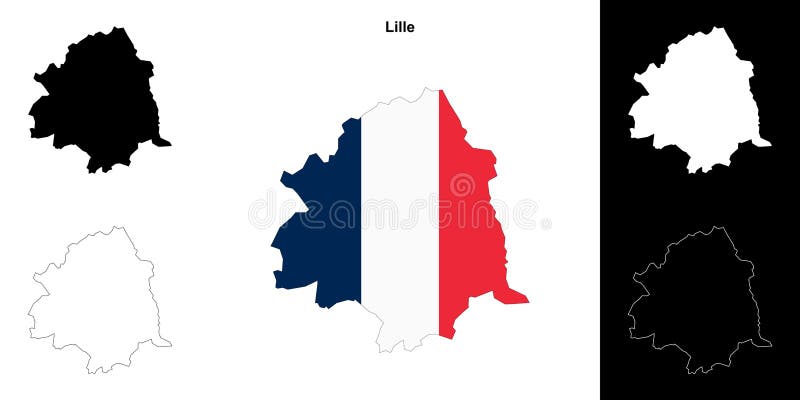
Free with trial Lille City Map Vector isolated illustration of simplified administrative, map of France Country design template designs concept, logos, logotype element for template. Lille territory vectors Lille City Map Vector isolated illustration of simplified administrative, map of France Country design template
Free with trial Lille. Administrative area of France highlighted and outlined on a darkened satellite image composed of Copernicus Sentinel tiles taken in May 2020. Lille territory illustrations Lille highlighted, France. Sentinel. May 2020. Lille. Administrative area of France highlighted and outlined on a darkened satellite image composed of Copernicus Sentinel tiles taken in May 2020
Free with trial Lille. Administrative area of France highlighted and outlined on a darkened satellite image composed of Copernicus Sentinel tiles taken in June 2023. Lille territory illustrations Lille highlighted, France. Sentinel. June 2023. Lille. Administrative area of France highlighted and outlined on a darkened satellite image composed of Copernicus Sentinel tiles taken in June 2023
Free with trial Lille. Administrative area of France highlighted and outlined on a darkened satellite image composed of Copernicus Sentinel tiles taken in April 2019. Lille territory illustrations Lille highlighted, France. Sentinel. April 2019. Lille. Administrative area of France highlighted and outlined on a darkened satellite image composed of Copernicus Sentinel tiles taken in April 2019
Free with trial Lille. Administrative area of France highlighted and outlined on a darkened satellite image composed of Copernicus Sentinel tiles taken in February 2022. Lille territory illustrations Lille highlighted, France. Sentinel. February 2022. Lille. Administrative area of France highlighted and outlined on a darkened satellite image composed of Copernicus Sentinel tiles taken in February 2022
Free with trial Lille. Administrative area of France highlighted and outlined on a darkened satellite image composed of Copernicus Sentinel tiles taken in September 2023. Lille territory illustrations Lille highlighted, France. Sentinel. September 2023. Lille. Administrative area of France highlighted and outlined on a darkened satellite image composed of Copernicus Sentinel tiles taken in September 2023
Free with trial Lille in the France emblem for print and web. Design features geometric style, vector illustration with bold typography in modern font. Graphic slogan lettering isolated on white background. Lille territory vectors Lille in the France emblem. The design features a geometric style, vector illustration with bold typography in a modern font. The. Lille in the France emblem for print and web. Design features geometric style, vector illustration with bold typography in modern font. Graphic slogan lettering isolated on white background
Free with trial French Flanders historical county in France. Vector travel plate, vintage tin sign, retro postcard design. Comte de Flandre old plaque with territory map and coat of arms, flag with lion. Lille territory vectors French Flanders Coutry, old travel plate. French Flanders historical county in France. Vector travel plate, vintage tin sign, retro postcard design. Comte de Flandre old plaque with territory map and coat of arms, flag with lion
Free with trial Nord. Administrative area of France on a satellite B imagery. Lille territory illustrations Nord, France. Satellite B. Nord. Administrative area of France on a satellite B imagery
Free with trial Arras. Administrative area of France on a satellite B imagery. Lille territory illustrations Arras, France. Satellite B. Arras. Administrative area of France on a satellite B imagery
Free with trial Hauts-de-France. Administrative area of France on a satellite B imagery. Lille territory illustrations Hauts-de-France, France. Satellite B. Hauts-de-France. Administrative area of France on a satellite B imagery
Free with trial Pas-de-Calais. Administrative area of France on a satellite B imagery. Lille territory illustrations Pas-de-Calais, France. Satellite B. Pas-de-Calais. Administrative area of France on a satellite B imagery
Free with trial Nord. Outlined administrative area of France on a satellite B imagery. Lille territory illustrations Nord outlined, France. Satellite B. Nord. Outlined administrative area of France on a satellite B imagery
Free with trial Arras. Outlined administrative area of France on a satellite B imagery. Lille territory illustrations Arras outlined, France. Satellite B. Arras. Outlined administrative area of France on a satellite B imagery
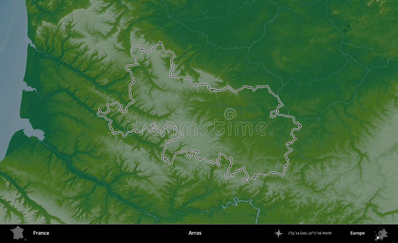
Free with trial Arras. Administrative area of France highlighted and outlined on a darkened colored elevation map. Lille territory illustrations Arras highlighted, France. Physical. Arras. Administrative area of France highlighted and outlined on a darkened colored elevation map
Free with trial Hainaut. Administrative area of Belgium outlined on a colored elevation map. Lille territory illustrations Hainaut outlined, Belgium. Physical. Hainaut. Administrative area of Belgium outlined on a colored elevation map
Free with trial Hainaut. Administrative area of Belgium outlined on a grayscale elevation map. Lille territory illustrations Hainaut outlined, Belgium. Grayscale. Hainaut. Administrative area of Belgium outlined on a grayscale elevation map
Free with trial Nord. Administrative area of France highlighted and outlined on a darkened satellite B imagery. Lille territory illustrations Nord highlighted, France. Satellite B. Nord. Administrative area of France highlighted and outlined on a darkened satellite B imagery
Free with trial Arras. Administrative area of France highlighted and outlined on a darkened satellite B imagery. Lille territory illustrations Arras highlighted, France. Satellite B. Arras. Administrative area of France highlighted and outlined on a darkened satellite B imagery
Free with trial Hauts-de-France. Outlined administrative area of France on a satellite B imagery. Lille territory illustrations Hauts-de-France outlined, France. Satellite B. Hauts-de-France. Outlined administrative area of France on a satellite B imagery
Free with trial Hauts-de-France. Administrative area of France highlighted and outlined on a darkened colored elevation map. Lille territory illustrations Hauts-de-France highlighted, France. Physical. Hauts-de-France. Administrative area of France highlighted and outlined on a darkened colored elevation map
Free with trial Hainaut. Administrative area of Belgium highlighted and outlined on a darkened colored elevation map. Lille territory illustrations Hainaut highlighted, Belgium. Physical. Hainaut. Administrative area of Belgium highlighted and outlined on a darkened colored elevation map
Free with trial Hainaut. Administrative area of Belgium highlighted and outlined on a darkened grayscale elevation map. Lille territory illustrations Hainaut highlighted, Belgium. Grayscale. Hainaut. Administrative area of Belgium highlighted and outlined on a darkened grayscale elevation map
Free with trial Pas-de-Calais. Outlined administrative area of France on a colored elevation map. Lille territory illustrations Pas-de-Calais outlined, France. Physical. Pas-de-Calais. Outlined administrative area of France on a colored elevation map
Free with trial Arras. Administrative area of France on a OpenStreetMap Humanitarian style map. Lille territory illustrations Arras, France. OpenStreetMap Humanitarian. Arras. Administrative area of France on a OpenStreetMap Humanitarian style map
Free with trial Hauts-de-France. Administrative area of France highlighted and outlined on a darkened satellite B imagery. Lille territory illustrations Hauts-de-France highlighted, France. Satellite B. Hauts-de-France. Administrative area of France highlighted and outlined on a darkened satellite B imagery
Free with trial Arras. Administrative area of France isolated on white on a colored elevation map. Lille territory illustrations Arras, France, isolated on white. Physical. Arras. Administrative area of France isolated on white on a colored elevation map
Free with trial Hainaut. Administrative area of Belgium on a Topographic Humanitarian style map. Lille territory illustrations Hainaut, Belgium. Topographic Humanitarian. Hainaut. Administrative area of Belgium on a Topographic Humanitarian style map
Free with trial Pas-de-Calais. Outlined administrative area of France on a satellite B imagery. Lille territory illustrations Pas-de-Calais outlined, France. Satellite B. Pas-de-Calais. Outlined administrative area of France on a satellite B imagery
Free with trial Nord. Administrative area of France isolated on white on a satellite B imagery. Lille territory illustrations Nord, France, isolated on white. Satellite B. Nord. Administrative area of France isolated on white on a satellite B imagery
Free with trial Hauts-de-France. Administrative area of France on a OpenStreetMap Humanitarian style map. Lille territory illustrations Hauts-de-France, France. OpenStreetMap Humanitarian. Hauts-de-France. Administrative area of France on a OpenStreetMap Humanitarian style map
Free with trial Arras. Administrative area of France isolated on white on a satellite B imagery. Lille territory illustrations Arras, France, isolated on white. Satellite B. Arras. Administrative area of France isolated on white on a satellite B imagery
Free with trial Tournai-Mouscron. Administrative area of Belgium outlined on a colored elevation map. Lille territory illustrations Tournai-Mouscron outlined, Belgium. Physical. Tournai-Mouscron. Administrative area of Belgium outlined on a colored elevation map
Free with trial Hainaut. Administrative area of Belgium isolated on white on a colored elevation map. Lille territory illustrations Hainaut, Belgium, isolated on white. Physical. Hainaut. Administrative area of Belgium isolated on white on a colored elevation map
Free with trial Tournai-Mouscron. Administrative area of Belgium outlined on a grayscale elevation map. Lille territory illustrations Tournai-Mouscron outlined, Belgium. Grayscale. Tournai-Mouscron. Administrative area of Belgium outlined on a grayscale elevation map
Free with trial Wallonie. Administrative area of Belgium isolated on white on a colored elevation map. Lille territory illustrations Wallonie, Belgium, isolated on white. Physical. Wallonie. Administrative area of Belgium isolated on white on a colored elevation map
Free with trial Hainaut. Administrative area of Belgium isolated on white on a grayscale elevation map. Lille territory illustrations Hainaut, Belgium, isolated on white. Grayscale. Hainaut. Administrative area of Belgium isolated on white on a grayscale elevation map
Free with trial Pas-de-Calais. Administrative area of France highlighted and outlined on a darkened satellite B imagery. Lille territory illustrations Pas-de-Calais highlighted, France. Satellite B. Pas-de-Calais. Administrative area of France highlighted and outlined on a darkened satellite B imagery
Free with trial Kge Kommune. Administrative area of Denmark on a Topographic Humanitarian style map. Lille territory illustrations Kge Kommune, Denmark. Topographic Humanitarian. Kge Kommune. Administrative area of Denmark on a Topographic Humanitarian style map
Free with trial Wallonie. Administrative area of Belgium isolated on white on a grayscale elevation map. Lille territory illustrations Wallonie, Belgium, isolated on white. Grayscale. Wallonie. Administrative area of Belgium isolated on white on a grayscale elevation map
Free with trial Hauts-de-France. Administrative area of France isolated on white on a satellite B imagery. Lille territory illustrations Hauts-de-France, France, isolated on white. Satellite B. Hauts-de-France. Administrative area of France isolated on white on a satellite B imagery
Free with trial Vlaanderen. Administrative area of Belgium isolated on white on a colored elevation map. Lille territory illustrations Vlaanderen, Belgium, isolated on white. Physical. Vlaanderen. Administrative area of Belgium isolated on white on a colored elevation map
Free with trial Tournai-Mouscron. Administrative area of Belgium highlighted and outlined on a darkened colored elevation map. Lille territory illustrations Tournai-Mouscron highlighted, Belgium. Physical. Tournai-Mouscron. Administrative area of Belgium highlighted and outlined on a darkened colored elevation map
Free with trial Tournai-Mouscron. Administrative area of Belgium highlighted and outlined on a darkened grayscale elevation map. Lille territory illustrations Tournai-Mouscron highlighted, Belgium. Grayscale. Tournai-Mouscron. Administrative area of Belgium highlighted and outlined on a darkened grayscale elevation map
Free with trial Vlaanderen. Administrative area of Belgium isolated on white on a grayscale elevation map. Lille territory illustrations Vlaanderen, Belgium, isolated on white. Grayscale. Vlaanderen. Administrative area of Belgium isolated on white on a grayscale elevation map
Free with trial Arras. Outlined administrative area of France on a OpenStreetMap Humanitarian style map. Lille territory illustrations Arras outlined, France. OpenStreetMap Humanitarian. Arras. Outlined administrative area of France on a OpenStreetMap Humanitarian style map
Free with trial Tournai-Mouscron. Administrative area of Belgium on a Topographic Humanitarian style map. Lille territory illustrations Tournai-Mouscron, Belgium. Topographic Humanitarian. Tournai-Mouscron. Administrative area of Belgium on a Topographic Humanitarian style map
Free with trial Hainaut. Administrative area of Belgium outlined on a Topographic Humanitarian style map. Lille territory illustrations Hainaut outlined, Belgium. Topographic Humanitarian. Hainaut. Administrative area of Belgium outlined on a Topographic Humanitarian style map
Free with trial Pas-de-Calais. Administrative area of France isolated on white on a satellite B imagery. Lille territory illustrations Pas-de-Calais, France, isolated on white. Satellite B. Pas-de-Calais. Administrative area of France isolated on white on a satellite B imagery
Free with trial Hauts-de-France. Outlined administrative area of France on a OpenStreetMap Humanitarian style map. Lille territory illustrations Hauts-de-France outlined, France. OpenStreetMap Humanitarian. Hauts-de-France. Outlined administrative area of France on a OpenStreetMap Humanitarian style map
Free with trial Arras. Administrative area of France highlighted and outlined on a darkened OpenStreetMap Humanitarian style map. Lille territory illustrations Arras highlighted, France. OpenStreetMap Humanitarian. Arras. Administrative area of France highlighted and outlined on a darkened OpenStreetMap Humanitarian style map
Free with trial Tournai-Mouscron. Administrative area of Belgium isolated on white on a colored elevation map. Lille territory illustrations Tournai-Mouscron, Belgium, isolated on white. Physical. Tournai-Mouscron. Administrative area of Belgium isolated on white on a colored elevation map
Free with trial Hainaut. Administrative area of Belgium highlighted and outlined on a darkened Topographic Humanitarian style map. Lille territory illustrations Hainaut highlighted, Belgium. Topographic Humanitarian. Hainaut. Administrative area of Belgium highlighted and outlined on a darkened Topographic Humanitarian style map
Free with trial Tournai-Mouscron. Administrative area of Belgium isolated on white on a grayscale elevation map. Lille territory illustrations Tournai-Mouscron, Belgium, isolated on white. Grayscale. Tournai-Mouscron. Administrative area of Belgium isolated on white on a grayscale elevation map
Free with trial Hauts-de-France. Administrative area of France highlighted and outlined on a darkened OpenStreetMap Humanitarian style map. Lille territory illustrations Hauts-de-France highlighted, France. OpenStreetMap Humanitarian. Hauts-de-France. Administrative area of France highlighted and outlined on a darkened OpenStreetMap Humanitarian style map
Free with trial Arras. Administrative area of France isolated on white on a OpenStreetMap Humanitarian style map. Lille territory illustrations Arras, France, isolated on white. OpenStreetMap Humanitarian. Arras. Administrative area of France isolated on white on a OpenStreetMap Humanitarian style map
Free with trial Tournai-Mouscron. Administrative area of Belgium outlined on a Topographic Humanitarian style map. Lille territory illustrations Tournai-Mouscron outlined, Belgium. Topographic Humanitarian. Tournai-Mouscron. Administrative area of Belgium outlined on a Topographic Humanitarian style map
Free with trial Hainaut. Administrative area of Belgium isolated on white on a Topographic Humanitarian style map. Lille territory illustrations Hainaut, Belgium, isolated on white. Topographic Humanitarian. Hainaut. Administrative area of Belgium isolated on white on a Topographic Humanitarian style map
Free with trial Wallonie. Administrative area of Belgium isolated on white on a Topographic Humanitarian style map. Lille territory illustrations Wallonie, Belgium, isolated on white. Topographic Humanitarian. Wallonie. Administrative area of Belgium isolated on white on a Topographic Humanitarian style map
Free with trial Hauts-de-France. Administrative area of France isolated on white on a OpenStreetMap Humanitarian style map. Lille territory illustrations Hauts-de-France, France, isolated on white. OpenStreetMap Humanitarian. Hauts-de-France. Administrative area of France isolated on white on a OpenStreetMap Humanitarian style map
Free with trial Vlaanderen. Administrative area of Belgium isolated on white on a Topographic Humanitarian style map. Lille territory illustrations Vlaanderen, Belgium, isolated on white. Topographic Humanitarian. Vlaanderen. Administrative area of Belgium isolated on white on a Topographic Humanitarian style map
Free with trial Tournai-Mouscron. Administrative area of Belgium highlighted and outlined on a darkened Topographic Humanitarian style map. Lille territory illustrations Tournai-Mouscron highlighted, Belgium. Topographic Humanitarian. Tournai-Mouscron. Administrative area of Belgium highlighted and outlined on a darkened Topographic Humanitarian style map
Free with trial Tournai-Mouscron. Administrative area of Belgium isolated on white on a Topographic Humanitarian style map. Lille territory illustrations Tournai-Mouscron, Belgium, isolated on white. Topographic Humanitarian. Tournai-Mouscron. Administrative area of Belgium isolated on white on a Topographic Humanitarian style map
Free with trial Arras. Outlined administrative area of France on a colored elevation map. Lille territory illustrations Arras outlined, France. Physical. Arras. Outlined administrative area of France on a colored elevation map
Free with trial Hauts-de-France. Outlined administrative area of France on a colored elevation map. Lille territory illustrations Hauts-de-France outlined, France. Physical. Hauts-de-France. Outlined administrative area of France on a colored elevation map
Free with trial Hauts-de-France. Administrative area of France isolated on white on a colored elevation map. Lille territory illustrations Hauts-de-France, France, isolated on white. Physical. Hauts-de-France. Administrative area of France isolated on white on a colored elevation map
Free with trial Aro Kommune. Administrative area of Denmark outlined on a colored elevation map. Lille territory illustrations Aro Kommune outlined, Denmark. Physical. Aro Kommune. Administrative area of Denmark outlined on a colored elevation map
Free with trial Aro Kommune. Administrative area of Denmark outlined on a grayscale elevation map. Lille territory illustrations Aro Kommune outlined, Denmark. Grayscale. Aro Kommune. Administrative area of Denmark outlined on a grayscale elevation map
Free with trial Koge Kommune. Administrative area of Denmark outlined on a colored elevation map. Lille territory illustrations Koge Kommune outlined, Denmark. Physical. Koge Kommune. Administrative area of Denmark outlined on a colored elevation map
Free with trial Koge Kommune. Administrative area of Denmark outlined on a grayscale elevation map. Lille territory illustrations Koge Kommune outlined, Denmark. Grayscale. Koge Kommune. Administrative area of Denmark outlined on a grayscale elevation map
Free with trial Samso Kommune. Administrative area of Denmark outlined on a colored elevation map. Lille territory illustrations Samso Kommune outlined, Denmark. Physical. Samso Kommune. Administrative area of Denmark outlined on a colored elevation map
Free with trial Aro Kommune. Administrative area of Denmark highlighted and outlined on a darkened colored elevation map. Lille territory illustrations Aro Kommune highlighted, Denmark. Physical. Aro Kommune. Administrative area of Denmark highlighted and outlined on a darkened colored elevation map
Free with trial Samso Kommune outlined, Denmark. Grayscale. Samso Kommune. Administrative area of Denmark outlined on a grayscale elevation map. Lille territory illustrations Samso Kommune outlined, Denmark. Grayscale. Samso Kommune. Administrative area of Denmark outlined on a grayscale elevation map
Free with trial Koge Kommune. Administrative area of Denmark highlighted and outlined on a darkened colored elevation map. Lille territory illustrations Koge Kommune highlighted, Denmark. Physical. Koge Kommune. Administrative area of Denmark highlighted and outlined on a darkened colored elevation map
Free with trial Aro Kommune. Administrative area of Denmark highlighted and outlined on a darkened grayscale elevation map. Lille territory illustrations Aro Kommune highlighted, Denmark. Grayscale. Aro Kommune. Administrative area of Denmark highlighted and outlined on a darkened grayscale elevation map
Free with trial Samso Kommune. Administrative area of Denmark highlighted and outlined on a darkened colored elevation map. Lille territory illustrations Samso Kommune highlighted, Denmark. Physical. Samso Kommune. Administrative area of Denmark highlighted and outlined on a darkened colored elevation map